LiDAR technology has emerged as a transformative tool across numerous industries, enabling precise three-dimensional mapping and spatial analysis. As the global LiDAR market expands rapidly, one of the key factors influencing its growth is the installation type, primarily categorized into airborne and ground-based systems. Each installation type serves distinct applications, markets, and technological demands, shaping unique trajectories for market development through 2030.
Airborne LiDAR: Expanding Horizons from Above
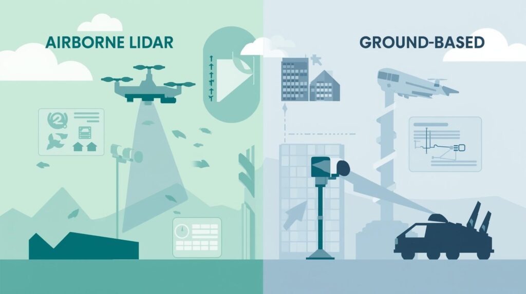
Airborne LiDAR systems are predominantly installed on aerial platforms such as drones, helicopters, and fixed-wing aircraft. This installation method is uniquely suited to large-scale terrain mapping, enabling the collection of high-resolution topographic data over expansive and often inaccessible areas. Governments and environmental agencies are increasingly leveraging airborne LiDAR to monitor natural resources, assess flood risks, and manage forest inventories. For example, airborne LiDAR allows for detailed analysis of vegetation structure and biomass, which is crucial for sustainable forestry practices and ecological research.
The agricultural sector is another significant beneficiary, with precision farming becoming more widespread due to the ability of airborne LiDAR to generate detailed elevation maps that guide irrigation, planting, and harvesting. Urban planners are also turning to airborne LiDAR to support smart city initiatives by creating accurate 3D models of urban landscapes, aiding in infrastructure development, traffic management, and disaster preparedness.
Technological advancements such as miniaturization of sensors and improvements in drone capabilities have made airborne LiDAR more accessible and cost-effective, which further accelerates market adoption. Integration with advanced geospatial analytics and real-time data processing platforms is enhancing the utility of airborne LiDAR, making it a preferred choice for large-area surveys.
Download PDF Brochure @ https://www.marketsandmarkets.com/pdfdownloadNew.asp?id=1261
Ground-Based LiDAR: Detailed Insight at Close Range
In contrast, ground-based LiDAR systems are installed on tripods, vehicles, or robotic platforms to scan environments at close range with exceptional detail. This installation type is vital for applications requiring high accuracy and object-level perception, including autonomous vehicles, construction monitoring, and industrial inspections. Autonomous vehicles rely heavily on ground-based LiDAR to perceive their surroundings in real time, detect obstacles, and navigate safely, making this installation type a cornerstone of the evolving self-driving car industry.
The construction and infrastructure sectors use ground-based LiDAR extensively for Building Information Modeling (BIM), quality control, and progress monitoring. It enables precise measurement of structural elements, detection of defects, and documentation of as-built conditions. Moreover, ground-based LiDAR contributes to industrial automation by supporting robotic navigation and equipment monitoring, driving efficiencies and safety improvements on factory floors.
Recent trends show that sensor miniaturization and cost reductions are making ground-based LiDAR more widely deployable, even beyond traditional industrial applications. When combined with artificial intelligence and machine learning algorithms, ground-based LiDAR is increasingly capable of object recognition, predictive maintenance, and automated inspection, enhancing its value across sectors.
Complementary Roles: A Holistic Approach to Spatial Intelligence
Rather than competing, airborne and ground-based LiDAR systems are increasingly seen as complementary technologies that together provide comprehensive spatial intelligence. Airborne LiDAR offers macro-level data, capturing vast areas with terrain contours, while ground-based LiDAR fills in the micro-level details necessary for object detection and fine-scale analysis. This layered data acquisition strategy is gaining traction in applications like digital twin creation, where a city or industrial facility is digitally replicated for simulation and planning purposes.
For instance, smart city projects often integrate data from airborne LiDAR surveys to understand overall urban topology and traffic flows, while ground-based LiDAR provides granular data on individual buildings, roadways, and utilities. This integrated approach supports better decision-making, improved asset management, and more effective urban governance.
Market Outlook and Future Trends
Looking ahead to 2030, the LiDAR market is poised for robust growth fueled by continuous innovation and expanding use cases. Hybrid deployments that combine airborne and ground-based LiDAR are expected to become more common, especially in sectors like transportation, environmental monitoring, and urban development. The introduction of next-generation technologies, such as solid-state and flash LiDAR, promises to enhance sensor performance while reducing costs and increasing durability.
Additionally, key industries such as automotive, aerospace, defense, agriculture, and construction are expected to drive demand, as LiDAR technology becomes indispensable for automation, precision mapping, and safety. Regional growth patterns indicate that North America and Asia-Pacific will lead market expansion due to significant investments in infrastructure and smart technology initiatives.
The market will also witness a trend toward greater integration of LiDAR with other sensing modalities, cloud computing, and AI-driven analytics, enabling more intelligent and actionable insights. This convergence will further unlock the potential of LiDAR systems, transcending traditional boundaries and creating new opportunities across diverse applications.
Conclusion: Navigating the Future of LiDAR Installations
Understanding the nuances between airborne and ground-based LiDAR installations is essential for stakeholders aiming to capitalize on the evolving market. Each installation type offers distinct advantages tailored to specific needs and applications. As technology advances and market dynamics evolve, the boundary between airborne and ground-based LiDAR will blur, leading to hybrid solutions that harness the strengths of both.
By 2030, the LiDAR market will not only grow in size but will also mature in capability and integration, fundamentally transforming how industries perceive and interact with their physical environments. For businesses, governments, and technology providers, the key to success lies in leveraging the right installation strategy to unlock maximum value from LiDAR’s powerful spatial sensing capabilities.
Frequently Asked Questions (FAQ) —
What is the difference between airborne and ground-based LiDAR?
Airborne LiDAR systems are mounted on aerial platforms such as drones, helicopters, or airplanes, enabling them to scan large areas from above. Ground-based LiDAR systems are installed on tripods, vehicles, or robots and capture detailed, close-range data of objects and environments at ground level. Each serves different applications depending on scale, resolution, and data needs.
What are the main applications of airborne LiDAR?
Airborne LiDAR is widely used for topographic mapping, forestry and agriculture monitoring, flood risk assessment, environmental research, and urban planning. It allows for rapid surveying of large, often inaccessible areas with high precision.
How is ground-based LiDAR used in autonomous vehicles?
Ground-based LiDAR provides real-time 3D mapping of the immediate environment around a vehicle. It detects obstacles, pedestrians, and road features, enabling autonomous systems to navigate safely and make informed driving decisions.
About MarketsandMarkets™
MarketsandMarkets™ has been recognized as one of America’s Best Management Consulting Firms by Forbes, as per their recent report.
MarketsandMarkets™ is a blue ocean alternative in growth consulting and program management, leveraging a man-machine offering to drive supernormal growth for progressive organizations in the B2B space. With the widest lens on emerging technologies, we are proficient in co-creating supernormal growth for clients across the globe.
Today, 80% of Fortune 2000 companies rely on MarketsandMarkets, and 90 of the top 100 companies in each sector trust us to accelerate their revenue growth. With a global clientele of over 13,000 organizations, we help businesses thrive in a disruptive ecosystem.
The B2B economy is witnessing the emergence of $25 trillion in new revenue streams that are replacing existing ones within this decade. We work with clients on growth programs, helping them monetize this $25 trillion opportunity through our service lines – TAM Expansion, Go-to-Market (GTM) Strategy to Execution, Market Share Gain, Account Enablement, and Thought Leadership Marketing.
Built on the ‘GIVE Growth’ principle, we collaborate with several Forbes Global 2000 B2B companies to keep them future-ready. Our insights and strategies are powered by industry experts, cutting-edge AI, and our Market Intelligence Cloud, KnowledgeStore™, which integrates research and provides ecosystem-wide visibility into revenue shifts.
To find out more, visit www.MarketsandMarkets™.com or follow us on Twitter , LinkedIn and Facebook .
Contact:
Mr. Rohan Salgarkar
MarketsandMarkets™ INC.
1615 South Congress Ave.
Suite 103, Delray Beach, FL 33445
USA: +1-888-600-6441
Visit Our Website: https://www.marketsandmarkets.com/