The satellite data services market has become one of the most influential industries shaping global decision making across agriculture, engineering, defense, infrastructure, and environmental monitoring. Satellite data services refer to the collection, analysis, and delivery of information obtained from Earth observation satellites. These services provide imagery, geospatial insights, and monitoring capabilities that are critical in modern industries where real time intelligence is the foundation for effective operations.
In recent years, the market has grown exponentially as demand for precision data and predictive analytics has risen. The increasing reliance on geospatial intelligence in both civil and defense applications has also strengthened the case for greater adoption of satellite based solutions. Emerging technologies like artificial intelligence and machine learning have amplified the value of satellite data by automating complex analysis processes and enabling faster, more accurate decision making.
As industries become more interconnected and reliant on digital ecosystems, the role of satellite data is shifting from being a supplementary tool to becoming a core operational necessity. This shift highlights the market’s trajectory toward continuous growth and innovation.
Satellite Data in Agriculture
One of the most significant verticals in the satellite data services market is agriculture. Farmers and agribusinesses have always been at the mercy of unpredictable weather patterns, crop diseases, and resource inefficiencies. The integration of satellite data services into agricultural operations has revolutionized farming by providing real time intelligence that supports precision agriculture.
Satellite imagery helps monitor crop growth cycles, soil conditions, and irrigation needs. By analyzing vegetation indices and weather data, farmers can predict yields more accurately and optimize resource utilization. This not only improves productivity but also minimizes waste and reduces the environmental footprint of agriculture.
Satellite data services play a critical role in early warning systems for crop diseases, pest infestations, and droughts. These systems provide actionable insights that allow farmers to take preventive measures well before significant damage occurs. As global demand for food increases and climate change continues to disrupt traditional farming patterns, the importance of satellite based agricultural intelligence will only grow.
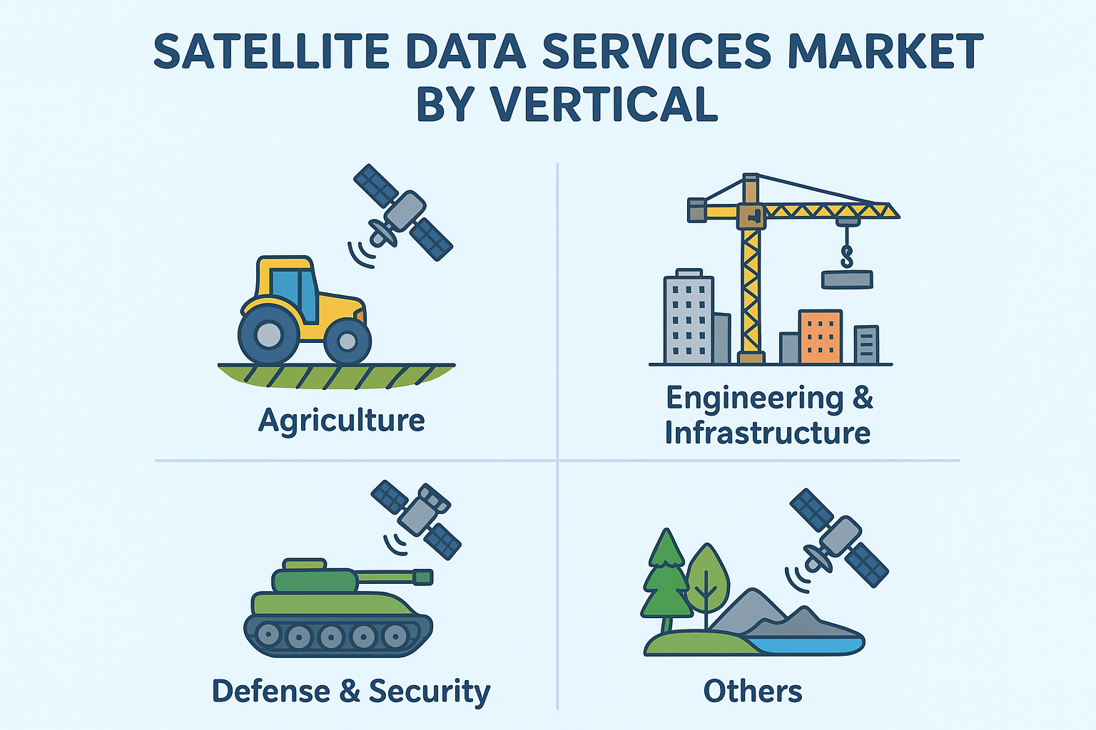
Role in Engineering and Infrastructure Development
The engineering and infrastructure sectors rely heavily on accurate geospatial data for planning, monitoring, and managing large scale projects. Satellite data services provide an unparalleled vantage point for overseeing urban expansion, transportation networks, and public utilities.
During the planning phase of infrastructure projects, satellite imagery helps identify suitable locations for construction by assessing topography, land use, and potential environmental impacts. This reduces project risks and ensures compliance with sustainability regulations. During construction, satellite monitoring enables real time progress tracking and quality assurance, which helps contractors and government agencies stay on schedule and within budget.
Another important application is in disaster risk management. Infrastructure resilience is a major priority worldwide, and satellites help monitor flood zones, seismic activity, and erosion risks that can compromise infrastructure stability. By integrating this data into early warning systems, governments and developers can mitigate losses and ensure long term resilience.
The rise of smart cities has further fueled demand for satellite data services. Smart infrastructure requires continuous monitoring of utilities, transportation, and environmental conditions. Satellite driven analytics empower city planners to optimize urban layouts and create sustainable living environments.
Defense and Security Applications
Defense and security remain dominant drivers of the satellite data services market. Governments and military organizations worldwide invest heavily in satellite based intelligence to secure borders, monitor maritime activities, and enhance national security.
Satellites provide real time surveillance of enemy movements, military installations, and potential threats. By combining satellite imagery with artificial intelligence, defense forces can quickly analyze patterns, predict enemy strategies, and make informed tactical decisions.
Maritime domain awareness is another critical area where satellite data plays a vital role. Monitoring illegal fishing, piracy, and naval activities requires persistent surveillance across vast ocean regions, something that satellites can deliver with high accuracy. Satellites aid in counter terrorism by tracking suspicious activities across regions that may otherwise be inaccessible to ground based monitoring systems.
With the increasing complexity of global security threats, the demand for advanced satellite services has expanded into cyber defense and space situational awareness. Satellite data helps identify potential cyber risks and monitor activities in orbit, protecting critical defense infrastructure from both physical and digital threats.
Emerging Applications in Other Verticals
Beyond agriculture, engineering, and defense, satellite data services have found applications in several other verticals that are becoming increasingly important. Environmental monitoring is a prime example, as climate change accelerates the need for accurate data to predict natural disasters and study ecosystem changes.
Satellites can track deforestation, melting glaciers, rising sea levels, and greenhouse gas emissions. Such insights are crucial for governments, NGOs, and researchers striving to implement climate action strategies. Satellites assist in monitoring air quality, water resources, and biodiversity, providing a comprehensive understanding of the planet’s health.
Natural resource exploration is another area benefiting from satellite data services. Oil, gas, and mineral exploration rely on satellite imagery to map geological formations and identify potential extraction sites. This reduces exploration costs while increasing accuracy and safety.
Other applications include disaster response, humanitarian aid coordination, and insurance risk assessment. Insurance companies increasingly use satellite data to assess claims, particularly after natural disasters, ensuring quicker payouts and better risk management.
Technology Advancements Driving Market Growth
The growth of satellite data services is strongly linked to advancements in technology. Artificial intelligence and machine learning have transformed the way satellite data is processed, enabling automated classification of images, predictive analytics, and anomaly detection.
Cloud platforms have also revolutionized the industry by offering scalable storage and processing capabilities. Satellite companies now deliver data as a service (DaaS), making high quality imagery accessible to a wide range of customers without the need for specialized infrastructure.
Improvements in satellite technology, such as high resolution imaging and hyperspectral sensors, have expanded the types of data that can be collected. CubeSats and small satellites have further democratized access by lowering launch costs and enabling frequent, cost effective data collection.
The integration of satellite data with emerging technologies like 5G and IoT has opened new avenues for real time monitoring in industries ranging from logistics to disaster response. As these technologies mature, the satellite data services market will continue to evolve, offering even more sophisticated solutions.
Regional Market Insights
The satellite data services market demonstrates varied growth patterns across different regions. North America leads the market, driven by strong defense spending, technological innovation, and widespread adoption in agriculture and infrastructure monitoring. The presence of major players like Maxar Technologies and Planet Labs further reinforces the region’s dominance.
Europe follows closely, with significant demand stemming from environmental monitoring and infrastructure projects. Initiatives by the European Space Agency (ESA) have created a strong ecosystem for research, innovation, and industry collaboration.
Asia Pacific is emerging as the fastest growing region due to rapid urbanization, infrastructure development, and government investment in space programs. Countries like China and India are deploying satellite constellations to meet domestic demands for connectivity, agriculture, and defense.
Latin America, Africa, and the Middle East also present promising opportunities, particularly in agriculture, natural resource exploration, and disaster management. These regions are increasingly turning to satellite data services to overcome infrastructure challenges and drive sustainable growth.
Key Players and Industry Collaborations
The satellite data services market is highly competitive, with several key players shaping the industry. Companies like Maxar Technologies, Planet Labs, Airbus, and BlackSky dominate the global market with advanced imaging and analytics solutions. These companies provide services to a wide range of customers, from governments to commercial enterprises.
Collaborations and partnerships have become essential strategies for growth. Public private partnerships, in particular, play a crucial role in enhancing service delivery. Governments often rely on commercial providers for high resolution data, while private companies benefit from government contracts that provide financial stability and market credibility.
Startups are also entering the market, leveraging small satellites and advanced analytics to offer niche services. Their agility and innovation are challenging established players and driving competition that benefits end users with improved services and lower costs.
Market Challenges and Restraints
Despite its rapid growth, the satellite data services market faces several challenges. High costs associated with satellite launches and data acquisition remain a barrier for smaller businesses and developing countries. Whilesmall satellites and CubeSats have reduced costs, the investment required is still significant.
Data privacy and regulatory issues are another major concern. The cross border nature of satellite imagery raises questions about sovereignty and data ownership. Governments often impose restrictions on the resolution and availability of satellite imagery, which can limit market accessibility.
Technical limitations also exist. Cloud cover and atmospheric interference can affect image quality, while the sheer volume of data generated creates challenges in storage, processing, and interpretation. Addressing these challenges requires continued investment in technology and collaboration among stakeholders.
Future Outlook of Satellite Data Services
The future of satellite data services is promising, with trends pointing toward increased adoption across industries. The proliferation of small satellites and mega constellations is expected to make data more affordable and accessible. Combined with AI and machine learning, this will unlock new applications in predictive analytics and real time decision making.
The integration of satellite data with emerging technologies like IoT and 5G will further expand the scope of applications. From smart cities to autonomous vehicles, satellite data will be a cornerstone of connected ecosystems.
Sustainability will also play a central role in shaping the market’s future. As the world grapples with climate change, satellite data will be instrumental in monitoring environmental impacts, guiding policy decisions, and enabling global cooperation.
The satellite data services market is set to become a key enabler of innovation, resilience, and sustainability across industries. Its ability to provide global insights and predictive intelligence ensures its position as one of the most transformative markets of the 21st century.