The LiDAR Market Analysis highlights how Light Detection and Ranging (LiDAR) technology is transforming automotive safety, autonomous mobility, surveying, mapping, and geospatial intelligence. By emitting laser pulses and measuring the time taken for reflected light to return, LiDAR systems capture accurate distance measurements and generate detailed three-dimensional (3D) representations of vehicles, buildings, roads, terrain, and other objects. These capabilities are making LiDAR an important technology for industries that require precise spatial data, real-time environmental perception, and advanced automation.
According to MarketsandMarkets, the global LiDAR market was valued at USD 3.27 billion in 2025 and is projected to reach USD 12.79 billion by 2030, registering a compound annual growth rate (CAGR) of 31.3% during the forecast period. Increasing adoption of advanced driver assistance systems (ADAS), autonomous vehicles, unmanned aerial vehicles (UAVs), digital mapping, and smart infrastructure is supporting this growth. Investments in smart cities, digital twins, and environmental monitoring are also expanding opportunities for LiDAR manufacturers and service providers.
LiDAR Market Analysis: Key Growth Drivers
Several technological and industrial developments are contributing to the expansion of the LiDAR Market. The growing need for accurate 3D data, safer transportation systems, and efficient infrastructure management is encouraging organizations to adopt laser-based sensing technologies.
One of the most important growth drivers is the increasing use of LiDAR in automotive applications. Automakers are integrating advanced sensing systems into vehicles to identify pedestrians, detect obstacles, measure distances, and support automated driving functions. LiDAR can provide detailed depth information that complements cameras, radar, and other vehicle sensors.
Another important driver is the growing demand for surveying and mapping solutions. Traditional surveying methods can require substantial time and labor, particularly across large, complex, or inaccessible locations. LiDAR systems mounted on vehicles, aircraft, and drones can capture extensive spatial information efficiently, helping professionals produce terrain models, infrastructure maps, and digital elevation models.
Infrastructure development is also contributing to market expansion. Road construction, railway development, bridge inspections, utility management, and urban planning require accurate measurements and updated spatial information. LiDAR enables engineers and planners to assess existing conditions, identify structural changes, and improve project design.
Furthermore, advances in sensor miniaturization, data-processing software, artificial intelligence (AI), and computing capabilities are improving the usability of LiDAR systems. These developments can help reduce operational complexity and support faster interpretation of large point-cloud data.
Download PDF Brochure @ https://www.marketsandmarkets.com/pdfdownloadNew.asp?id=1261
Emerging Applications of LiDAR in the Automotive Industry
The automotive industry is one of the most significant areas of opportunity identified in LiDAR Market Analysis. Vehicle manufacturers are increasingly investing in sensing technologies that improve road safety, support driver assistance, and enable higher levels of driving automation. LiDAR helps vehicles measure the distance to surrounding objects and construct a detailed view of their environment.
Advanced Driver Assistance Systems (ADAS)
ADAS applications are creating new opportunities for LiDAR technology. Features such as collision avoidance, adaptive cruise control, pedestrian detection, and emergency braking depend on accurate environmental perception. LiDAR can supply precise depth information to help vehicles identify obstacles and estimate their distance.
When integrated with cameras and radar, LiDAR can contribute to a more comprehensive understanding of road conditions. This sensor-fusion approach helps automotive systems combine visual recognition, distance measurements, and object-tracking information.
As automakers expand ADAS features across passenger and commercial vehicles, demand for compact, reliable, and cost-effective LiDAR sensors is expected to increase. However, adoption depends on system pricing, performance in different weather conditions, integration requirements, and automakers’ vehicle-platform strategies.
Autonomous and Driverless Vehicles
Autonomous driving is another important application shaping the LiDAR Market. Self-driving vehicles need to detect road boundaries, recognize nearby objects, estimate distances, and respond to changing traffic conditions. LiDAR systems generate detailed 3D point clouds that help automated driving software interpret the vehicle’s surroundings.
This capability is relevant to robotaxis, autonomous shuttles, delivery vehicles, and selected commercial transportation applications. LiDAR can support object detection and localization, while AI-based software interprets sensor data to inform navigation and driving decisions.
The development of solid-state LiDAR is particularly relevant because these systems can be designed with fewer moving components than traditional mechanical configurations. Depending on their design, solid-state systems can support compact packaging and integration into vehicle bodies. Manufacturers are also working to improve detection range, resolution, reliability, and production economics.
Nevertheless, LiDAR alone cannot guarantee autonomous driving safety. Effective deployment requires sensor fusion, advanced software, extensive testing, redundancy, and compliance with applicable automotive safety standards.
Vehicle Mapping and Parking Assistance
LiDAR also has applications in low-speed vehicle functions, including automated parking and maneuvering in confined environments. Short-range sensing can help vehicles detect nearby objects, estimate clearances, and identify obstacles that may be difficult for drivers to see.
In addition, LiDAR-derived road information can support high-definition mapping and vehicle localization. These capabilities are relevant to automated driving systems that require detailed information about road geometry, lane boundaries, and nearby infrastructure.
As automakers develop increasingly connected vehicles, LiDAR Market Analysis points to opportunities for suppliers that can deliver compact sensors, efficient processing systems, and software compatible with vehicle computing platforms.
Emerging Applications of LiDAR in Geospatial Industries
Geospatial applications represent another major area of opportunity. LiDAR captures precise elevation and surface information that can be used to create digital terrain models, 3D city models, infrastructure maps, and other spatial datasets. These outputs support decision-making across construction, transportation, environmental management, mining, and public-sector planning.
Surveying and 3D Mapping
Surveying and mapping are core applications of LiDAR technology. Ground-based scanners capture detailed measurements of buildings, roads, industrial facilities, and construction sites. Airborne systems collect spatial information over larger areas using aircraft or drones.
The resulting point-cloud data can be processed into 3D models, contour maps, and digital elevation models. These outputs help surveyors reduce manual measurement requirements and improve the consistency of spatial information.
LiDAR is particularly useful for projects involving complex terrain, large infrastructure networks, or locations where conventional surveying would be difficult. Its ability to capture dense spatial data also supports change detection and repeat measurements over time.
The expansion of digital mapping, geographic information systems (GIS), and digital twins is creating further opportunities for LiDAR service providers. Organizations can combine LiDAR datasets with other geospatial information to develop more detailed representations of physical assets and environments.
Infrastructure and Corridor Mapping
Roads, railways, bridges, pipelines, and power transmission corridors require regular surveying and inspection. LiDAR can capture the geometry of these assets, identify changes in surrounding terrain, and provide measurements that support engineering assessments.
For transportation projects, LiDAR-based corridor mapping can help engineers evaluate road alignments, slopes, clearances, and surrounding structures. Railway operators can use spatial data to assess trackside environments, while utilities can map vegetation and nearby infrastructure along transmission routes.
The technology is also relevant to construction monitoring. Comparing scans collected at different stages of a project can help teams evaluate progress, identify deviations from design specifications, and improve documentation.
As infrastructure owners focus on asset visibility and maintenance planning, LiDAR Market Analysis identifies opportunities for solutions that combine high-accuracy sensing with cloud-based data management and engineering software.
Urban Planning and Smart Cities
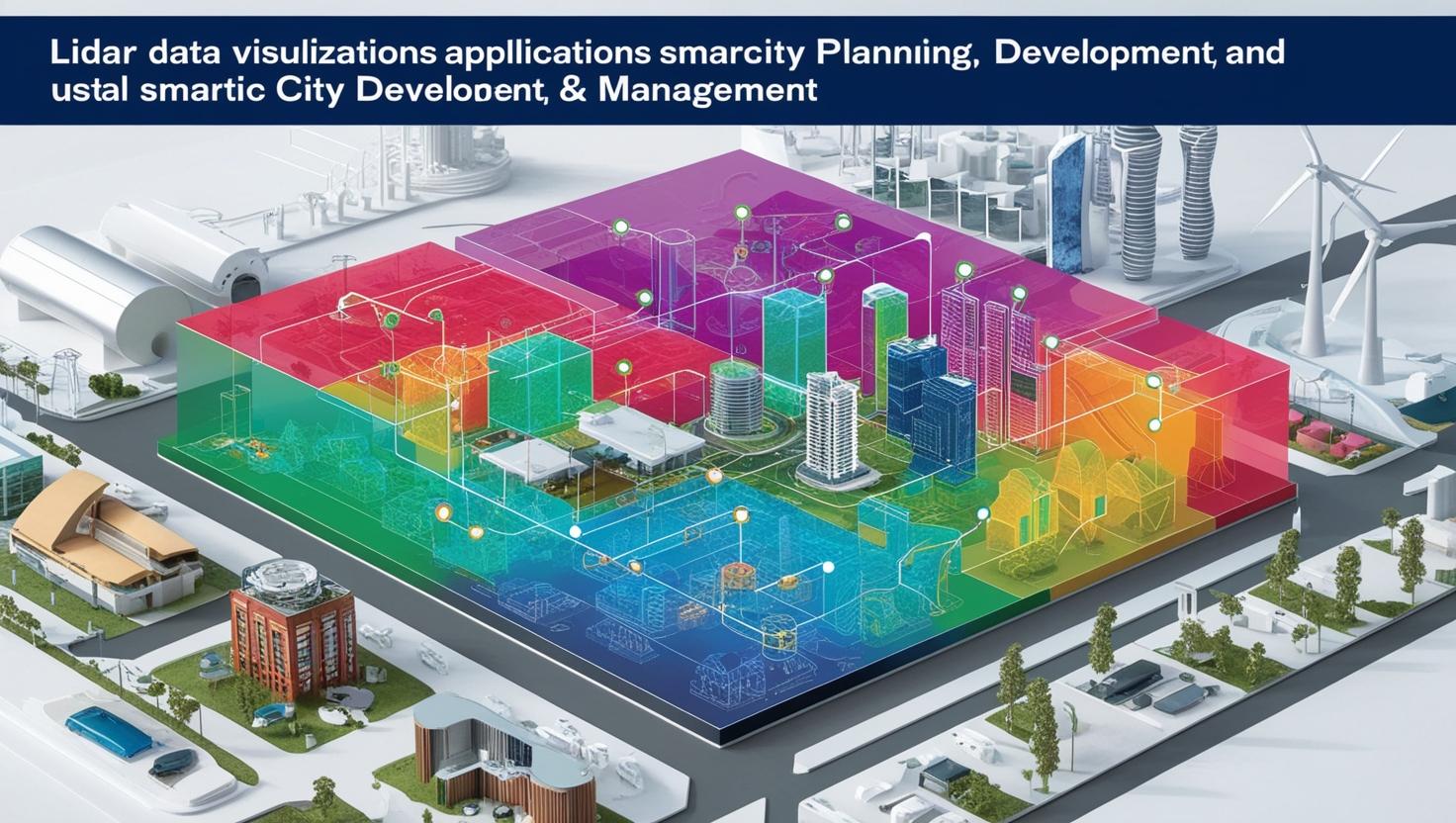
Urban planners increasingly need accurate information about buildings, road networks, public spaces, and transportation infrastructure. LiDAR supports the creation of detailed 3D city models that can inform land-use planning, traffic studies, infrastructure development, and disaster preparedness.
When integrated with GIS platforms and digital-twin technologies, LiDAR data can help municipalities maintain updated digital representations of the built environment. These models may support simulations, development assessments, and the evaluation of proposed infrastructure projects.
Smart-city initiatives can also use LiDAR-derived information to support urban mobility planning and infrastructure management. For example, precise road and building geometry can contribute to transport planning and the assessment of pedestrian infrastructure.
The growing use of digital twins is particularly important because these platforms rely on accurate spatial data to represent real-world assets. LiDAR provides one method of collecting this information, although its effectiveness depends on data quality, update frequency, integration, and project requirements.
Environmental Monitoring and Forestry
Environmental monitoring is another emerging application in the LiDAR Market. Airborne and UAV-mounted LiDAR systems can collect elevation and vegetation data across forests, watersheds, coastlines, and other natural environments.
In forestry, LiDAR can help estimate canopy height, characterize vegetation structure, and support assessments of forest biomass. Environmental researchers can use terrain information to study landscape changes, erosion patterns, and habitat conditions.
LiDAR is also relevant to flood-risk assessment because detailed elevation models can improve understanding of land contours and potential water-flow pathways. When combined with hydrological models and other datasets, these measurements can support planning and risk evaluation.
Collecting data in remote or hazardous areas is another advantage. UAV-mounted systems can access locations that are difficult to survey manually, although flight permissions, weather, sensor payload, and data-processing costs can affect deployment.
LiDAR Market Analysis by Technology and Installation
Technology selection plays an important role in determining how LiDAR systems are deployed. The market is commonly segmented by installation, type, range, service, end-use application, and region.
Mechanical LiDAR and Solid-State LiDAR
Mechanical LiDAR systems use moving components to direct laser beams across the surrounding environment. Their scanning capabilities and wide field of view have supported applications such as engineering, corridor mapping, surveying, and other large-scale measurement activities.
Solid-state LiDAR is attracting attention for automotive and compact sensing applications. Depending on the architecture, solid-state designs can reduce reliance on moving parts and support integration into smaller systems. Continued development focuses on improving resolution, reliability, detection range, and manufacturing costs.
Both approaches have distinct advantages and limitations. The appropriate choice depends on the intended application, environmental conditions, required accuracy, field of view, and overall system cost.
Ground-Based and Airborne LiDAR
Ground-based LiDAR is widely used in surveying, engineering, infrastructure measurement, and mapping. Its deployment can be suitable for projects that require detailed measurements of specific assets or locations.
Airborne LiDAR, including systems mounted on drones and aircraft, is useful for collecting spatial data across extensive areas. It can support aerial surveying, topographic mapping, environmental assessment, and corridor inspections.
MarketsandMarkets identifies ground-based LiDAR as the larger installation segment in its market overview. The report also highlights aerial surveying as an important service application because of its use in inspecting roads, railways, highways, and bridges.
Short-, Medium-, and Long-Range LiDAR
LiDAR range requirements differ across applications. Short-range systems are relevant to robotics, security, automotive maneuvering, and nearby-object detection. Medium-range systems can serve applications requiring broader environmental coverage, while long-range systems are useful when detecting objects or measuring terrain over greater distances.
Selecting a suitable range involves balancing detection performance, resolution, field of view, power consumption, and cost. Automotive manufacturers, for example, may require different sensing capabilities for highway driving and low-speed parking functions.
Regional Opportunities in the LiDAR Market
Regional infrastructure investment, industrial development, and technology adoption influence demand for LiDAR systems.
Asia Pacific
Asia Pacific is projected by MarketsandMarkets to be the fastest-growing regional market during the forecast period. Infrastructure development, surveying and mapping requirements, mining activities, and forest management are contributing to regional opportunities.
Investment in smart cities, transportation networks, and advanced automotive technologies can further support demand. Suppliers that offer scalable sensing systems and local technical support may be well positioned to serve customers across diverse applications.
North America
North America presents opportunities across automotive technology, geospatial services, infrastructure management, and environmental monitoring. Investments in ADAS, autonomous mobility, digital mapping, and engineering applications support the use of LiDAR-based solutions.
The region also has an established ecosystem of technology developers, surveying firms, and infrastructure service providers. Collaboration between sensor manufacturers and software companies can help accelerate deployment.
Europe
Europe offers opportunities in automotive safety, industrial measurement, surveying, and transportation infrastructure. The region’s automotive ecosystem creates demand for advanced sensing technologies, while infrastructure modernization and digitalization support geospatial applications.
Adoption will depend on regulatory requirements, procurement priorities, integration costs, and the ability of LiDAR solutions to meet performance expectations in specific applications.
Challenges Affecting LiDAR Market Growth
Despite its growth potential, the LiDAR Market faces several challenges. High equipment costs and specialized data-processing requirements can limit adoption among smaller surveying firms and organizations with restricted budgets. System costs may include sensors, mounting equipment, software licenses, computing resources, and technical expertise.
Competition from photogrammetry and other sensing technologies is another factor. Photogrammetry can provide useful 2D and 3D outputs at a lower cost for some mapping applications. The most appropriate technology depends on the required accuracy, terrain, vegetation, project scale, and operating conditions.
Environmental performance also matters. Heavy precipitation, fog, dust, reflective surfaces, and other challenging conditions can affect sensor performance. Automotive systems must also meet strict reliability and safety expectations.
Large volumes of point-cloud data create additional demands for storage, processing, and integration. Organizations need suitable software and skilled personnel to convert collected data into actionable information. Improvements in automated processing and AI-assisted analysis may help address these challenges, but implementation costs and data quality remain important considerations.
Competitive Landscape and Key Companies
Competition in the LiDAR Market involves sensor manufacturers, system integrators, geospatial technology providers, and software developers. Companies compete through product innovation, sensing performance, cost reduction, partnerships, and expansion into new applications.
Key companies identified in the MarketsandMarkets report include Hesai Group, RoboSense Technology Co., Ltd., SICK AG, Ouster, Inc., Luminar Technologies, Leica Geosystems AG, Trimble Inc., Teledyne Optech, FARO Technologies, and RIEGL Laser Measurement Systems.
Product development is focused on improving sensor performance, reducing system size, expanding application coverage, and simplifying integration. Partnerships between LiDAR manufacturers and automotive or geospatial companies can also help suppliers address specific customer requirements.
For industry participants, competitive differentiation depends on more than sensor specifications. Software compatibility, data quality, system reliability, production scale, customer support, and total cost of ownership can influence purchasing decisions.
Future Outlook for the LiDAR Market
The future of the LiDAR Market will be shaped by developments in autonomous mobility, 3D mapping, smart infrastructure, and automated data analysis. In automotive applications, progress in sensor design and integration may expand opportunities in ADAS and driverless systems. In geospatial industries, demand for accurate digital representations of terrain and infrastructure is likely to support the use of ground-based, airborne, and UAV-mounted LiDAR.
AI-assisted processing and cloud-based platforms can help organizations analyze large datasets more efficiently. Integration with GIS, digital twins, and other engineering systems may also increase the value of LiDAR data by connecting precise measurements with planning and operational workflows.
However, market expansion will depend on cost reductions, technical performance, customer requirements, and the availability of qualified professionals. Companies that combine reliable sensing hardware with efficient software and application-specific solutions will be better positioned to address these needs.
The LiDAR Market Analysis demonstrates the growing importance of 3D sensing across automotive and geospatial industries. From ADAS and autonomous vehicles to surveying, corridor mapping, environmental monitoring, and smart-city development, LiDAR is helping organizations collect precise spatial information and improve decision-making.
The global market is projected to grow from USD 3.27 billion in 2025 to USD 12.79 billion by 2030, at a CAGR of 31.3%, according to MarketsandMarkets. Emerging opportunities will depend on advances in sensor technology, improved data processing, expanding infrastructure projects, and broader adoption of automated systems.
For manufacturers, technology providers, and service companies, the strongest opportunities lie in delivering accurate, scalable, and cost-effective LiDAR solutions tailored to specific industry needs.
FAQ
1. What is the projected growth of the LiDAR Market?
The LiDAR Market is projected to grow from USD 3.27 billion in 2025 to USD 12.79 billion by 2030, at a CAGR of 31.3%.
2. What are the key factors driving LiDAR Market growth?
Key growth drivers include increasing adoption of autonomous vehicles, advanced driver assistance systems (ADAS), 3D mapping, infrastructure development, and smart-city initiatives.
3. What are the major applications of LiDAR technology?
Major applications include autonomous driving, surveying and mapping, aerial surveying, infrastructure inspection, environmental monitoring, forestry, and urban planning.
4. Which region is expected to grow fastest in the LiDAR Market?
Asia Pacific is projected to be the fastest-growing regional market, supported by infrastructure development, surveying requirements, and increasing adoption of advanced technologies.
5. Who are the key players in the LiDAR Market?
Key players include Hesai Group, RoboSense, SICK AG, Ouster, Luminar Technologies, Leica Geosystems, Trimble, Teledyne Optech, FARO Technologies, and RIEGL.
About MarketsandMarkets™
MarketsandMarkets™ has been recognized as one of America’s Best Management Consulting Firms by Forbes, as per their recent report.
MarketsandMarkets™ is a blue ocean alternative in growth consulting and program management, leveraging a man-machine offering to drive supernormal growth for progressive organizations in the B2B space. With the widest lens on emerging technologies, we are proficient in co-creating supernormal growth for clients across the globe.
Today, 80% of Fortune 2000 companies rely on MarketsandMarkets, and 90 of the top 100 companies in each sector trust us to accelerate their revenue growth. With a global clientele of over 13,000 organizations, we help businesses thrive in a disruptive ecosystem.
The B2B economy is witnessing the emergence of $25 trillion in new revenue streams that are replacing existing ones within this decade. We work with clients on growth programs, helping them monetize this $25 trillion opportunity through our service lines – TAM Expansion, Go-to-Market (GTM) Strategy to Execution, Market Share Gain, Account Enablement, and Thought Leadership Marketing.
Built on the ‘GIVE Growth’ principle, we collaborate with several Forbes Global 2000 B2B companies to keep them future-ready. Our insights and strategies are powered by industry experts, cutting-edge AI, and our Market Intelligence Cloud, KnowledgeStore™, which integrates research and provides ecosystem-wide visibility into revenue shifts.
To find out more, visit www.MarketsandMarkets™.com or follow us on Twitter , LinkedIn and Facebook .
Contact:
Mr. Rohan Salgarkar
MarketsandMarkets™ INC.
1615 South Congress Ave.
Suite 103, Delray Beach, FL 33445
USA: +1-888-600-6441