The LiDAR Technology Market is emerging as a critical component of next-generation sensing, autonomous mobility, digital mapping, and geospatial intelligence. Light Detection and Ranging (LiDAR) technology uses laser pulses to measure distances and generate highly accurate three-dimensional representations of surrounding environments. Its ability to deliver precise depth information is making LiDAR increasingly important across autonomous vehicles, advanced driver assistance systems (ADAS), robotics, surveying, infrastructure development, environmental monitoring, and smart-city applications.
According to MarketsandMarkets, the global LiDAR market is projected to grow from USD 3.27 billion in 2025 to USD 12.79 billion by 2030, registering a CAGR of 31.3% from 2025 to 2030. Rising adoption of autonomous vehicles, increasing demand for 3D imaging, UAV-based surveying, digital twins, smart infrastructure, and advanced geospatial solutions are contributing to this expansion.
The evolution of LiDAR from large mechanical scanning systems toward compact, solid-state, and software-defined sensing platforms is further broadening its applications. Integration with artificial intelligence (AI), edge computing, cloud platforms, and advanced analytics is enabling LiDAR-generated point clouds to be converted into actionable information for real-time decision-making.
LiDAR Technology Market Growth Driven by Autonomous Mobility
Autonomous mobility is one of the most important growth areas for the LiDAR Technology Market. Autonomous vehicles need accurate environmental perception to detect pedestrians, vehicles, road infrastructure, obstacles, and other objects. LiDAR complements cameras and radar by providing detailed three-dimensional distance information.
The MarketsandMarkets analysis identifies ADAS and driverless cars as the leading end-use application segment during the forecast period. Increasing deployment of LiDAR in Level 2 and Level 3 automated vehicles, together with continued development of higher levels of vehicle automation, is supporting demand for advanced sensing systems.
LiDAR can support functions such as object detection, obstacle avoidance, lane and road-edge recognition, and high-definition environmental mapping. As automotive manufacturers and technology companies develop autonomous driving platforms, the need for accurate and reliable perception technologies is increasing.
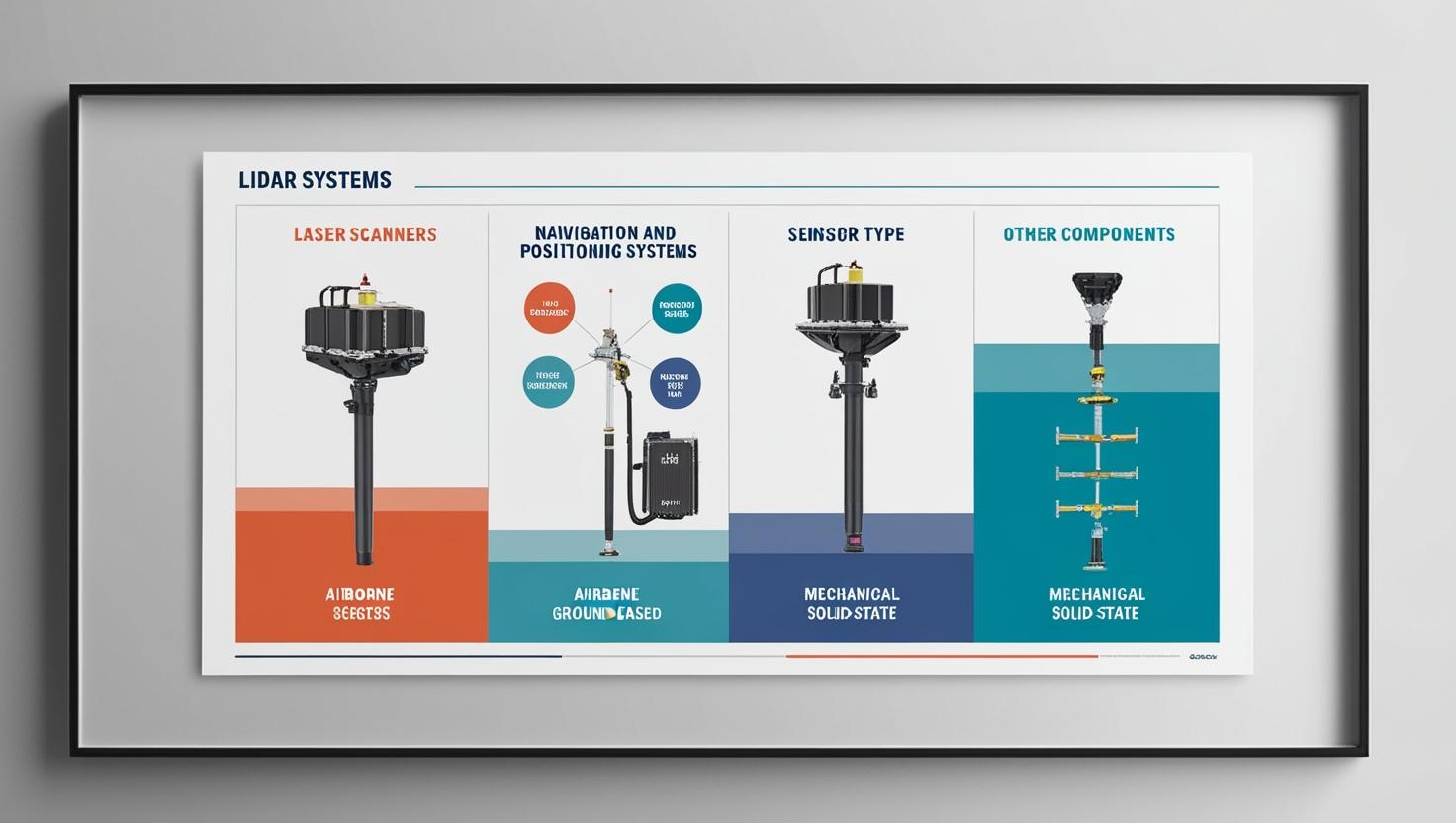
The transition toward solid-state LiDAR is particularly significant. Compared with conventional mechanically scanning systems, solid-state architectures can offer opportunities for smaller form factors, improved durability, and easier integration into vehicle platforms. This is encouraging LiDAR suppliers to focus on cost reduction, range, resolution, reliability, and scalability.
Download PDF Brochure @ https://www.marketsandmarkets.com/pdfdownloadNew.asp?id=1261
AI and 3D Perception Transforming LiDAR Applications
Artificial intelligence is changing how LiDAR data is processed and used. Conventional LiDAR systems primarily focused on collecting spatial information, while modern solutions increasingly combine sensors with AI algorithms capable of interpreting complex point-cloud data.
AI can support object classification, segmentation, tracking, anomaly detection, and environmental understanding. In autonomous vehicles, these capabilities can help perception systems identify and differentiate vehicles, pedestrians, cyclists, road infrastructure, and other objects.
The combination of LiDAR technology and AI is also creating opportunities outside automotive applications. Robotics systems can use LiDAR-generated maps for navigation and localization. Industrial facilities can use 3D sensing for automation, inspection, and asset monitoring. Smart-city platforms can combine LiDAR data with other datasets to develop digital representations of urban environments.
Edge computing is also becoming important because processing LiDAR data close to the sensor can reduce latency and bandwidth requirements. This is particularly relevant for autonomous vehicles, drones, robots, and other applications where rapid decisions are required.
Geospatial Intelligence and 3D Mapping Expand Market Opportunities
Geospatial intelligence represents another major opportunity for the LiDAR Technology Market. LiDAR can capture highly detailed terrain and infrastructure information, enabling organizations to develop accurate 3D models, digital elevation models, and spatial datasets.
LiDAR-based surveying is increasingly used for roads, railways, bridges, utilities, construction sites, forests, mines, and urban environments. Compared with conventional surveying approaches, LiDAR can rapidly collect large volumes of three-dimensional information and support surveying in difficult or inaccessible locations.
The technology is also contributing to the development of digital twins. Urban planners and infrastructure developers can use LiDAR-derived 3D models as inputs for digital representations of buildings, roads, utilities, and other assets. These models can support planning, monitoring, maintenance, and simulation.
The MarketsandMarkets report identifies growing smart-city and infrastructure development projects as important drivers of LiDAR adoption. Increasing demand for precise 3D imaging and geospatial analysis is creating opportunities for LiDAR providers across mapping, engineering, urban planning, and asset-management applications.
UAV LiDAR Accelerates Surveying and Remote Data Collection
The adoption of UAV-based LiDAR is another important growth driver. Drones equipped with LiDAR sensors can collect accurate spatial information across large or difficult-to-access areas while reducing the need for extensive manual surveying.
UAV LiDAR systems are increasingly relevant for corridor mapping, infrastructure inspection, environmental monitoring, forestry, mining, construction, and engineering. Drones can operate in locations where conventional surveying methods may be time-consuming or difficult to deploy.
LiDAR-equipped UAVs can generate three-dimensional representations and digital elevation models that support engineering and environmental analysis. This capability is particularly useful for monitoring remote areas, hazardous terrain, and large infrastructure corridors.
The increasing availability of compact sensors and improvements in portability are helping expand UAV LiDAR applications. As drone platforms become more capable and LiDAR systems become smaller and more efficient, the integration of sensing, navigation, AI, and cloud-based processing is expected to create additional opportunities.
Solid-State LiDAR and Sensor Innovation
Technology development remains central to the growth of the LiDAR Technology Market. Mechanical LiDAR systems have historically been widely used because of their wide field of view and long-range capabilities. MarketsandMarkets reports that mechanical LiDAR held a larger market share in 2024, particularly across corridor mapping, military, volumetric mapping, and engineering applications.
At the same time, solid-state LiDAR is gaining attention in automotive and autonomous applications. Manufacturers are working to develop smaller, more robust, and cost-efficient architectures that can be integrated into vehicles and mobile platforms.
Short-range LiDAR is projected to lead the market because of its adoption in automobiles, security, and robotics, while medium-range LiDAR is expected to grow rapidly in engineering and construction applications.
Emerging developments such as flash LiDAR, improved detectors, advanced signal processing, and quantum-dot detector technologies could further influence the technology landscape. These developments are focused on improving detection performance while reducing system size, cost, and complexity.
Ground-Based and Airborne LiDAR Applications
LiDAR systems can broadly be categorized by installation into ground-based and airborne platforms. Ground-based LiDAR currently accounts for a larger market share and is projected to grow at a higher CAGR than airborne LiDAR, according to MarketsandMarkets. Lower costs and comparatively simpler approval requirements for mapping and surveying applications are among the factors supporting ground-based deployment.
Ground-based systems are used across environmental monitoring, meteorology, corridor mapping, ADAS, driverless vehicles, and surveying. Mobile and stationary LiDAR platforms can provide detailed measurements of terrain, infrastructure, and surrounding environments.
Airborne LiDAR, meanwhile, remains important for large-area mapping. Aircraft and drones can cover extensive geographic areas and collect data for topographic mapping, environmental assessment, forestry, coastal monitoring, and infrastructure planning.
Aerial surveying is projected to hold the largest share by service during the forecast period because of its use in inspecting roads, railways, highways, bridges, and other infrastructure.
Smart Cities and Infrastructure Drive LiDAR Adoption
The development of smart cities is creating new applications for LiDAR technology. Municipal authorities and infrastructure developers increasingly require accurate spatial data to plan transportation networks, monitor infrastructure, analyze urban growth, and manage public assets.
LiDAR can provide detailed three-dimensional information for roads, buildings, utility networks, vegetation, and other urban elements. When combined with GIS, AI, cloud computing, and digital twins, this information can support more data-driven urban planning.
Infrastructure projects also benefit from LiDAR-based inspection and surveying. Roads, bridges, tunnels, railways, power infrastructure, and construction sites can be scanned to identify structural or geometric changes and improve project documentation.
As infrastructure investments increase across emerging markets, demand for accurate and efficient surveying technologies is expected to expand.
Asia Pacific Emerging as a High-Growth LiDAR Market
Regional development is an important component of the LiDAR Technology Market outlook. Asia Pacific is projected to register the highest CAGR during the forecast period. MarketsandMarkets estimates that the Asia Pacific LiDAR market will increase from USD 0.92 billion in 2025 to USD 4.01 billion by 2030, representing a 34.1% CAGR.
Growing infrastructure development, surveying and mapping activities, mining, forest management, autonomous vehicles, robotics, and smart-city programs are supporting regional demand.
North America is also a significant market, with its LiDAR market projected to reach USD 4.8 billion by 2030 from USD 1.25 billion in 2025, at a CAGR of 30.9%. Autonomous and ADAS-enabled vehicles, partnerships between automotive companies and LiDAR suppliers, and robotics applications are contributing to regional growth.
Europe is projected to reach USD 3.16 billion by 2030 from USD 0.87 billion in 2025, representing a CAGR of 29.6%. Autonomous driving, smart mobility, environmental monitoring, infrastructure planning, and advanced mapping initiatives are supporting LiDAR adoption in the region.
Challenges Facing the LiDAR Technology Market
Despite strong growth opportunities, the LiDAR Technology Market faces several challenges. High system and post-processing costs can limit adoption, particularly among smaller organizations and projects with constrained budgets.
MarketsandMarkets identifies the availability of low-cost and lightweight alternatives as a restraint. Photogrammetry, for example, can provide 2D and 3D mapping outputs at lower costs for certain surveying applications.
Another challenge is the complexity associated with miniaturizing LiDAR systems. Automotive and robotics applications require compact sensors that maintain high accuracy, range, reliability, and performance while meeting strict size and cost requirements.
The cost of post-processing software can also add to the overall expense of LiDAR-based projects. As the technology becomes more widespread, software automation, cloud processing, AI-based point-cloud analysis, and standardized workflows could help improve cost efficiency.
Future Outlook for the LiDAR Technology Market
The future of the LiDAR Technology Market is closely linked to the convergence of sensing, AI, automation, robotics, and geospatial intelligence. Automotive applications are expected to remain a major area of development as manufacturers integrate advanced perception technologies into increasingly automated vehicles.
At the same time, LiDAR is moving beyond autonomous mobility into infrastructure, construction, environmental monitoring, industrial automation, drones, agriculture, mining, and smart cities.
The development of compact solid-state systems, flash LiDAR, improved detectors, AI-enabled point-cloud analytics, and edge processing is expected to expand the range of applications. Increasing integration with digital twins and cloud-based geospatial platforms could further increase the value of LiDAR-generated data.
With the global market projected to reach USD 12.79 billion by 2030 from USD 3.27 billion in 2025, the LiDAR Technology Market is positioned for substantial expansion over the forecast period.
Overall, LiDAR is evolving from a specialized mapping technology into a broader sensing platform for autonomous mobility and intelligent infrastructure. Its combination of precise 3D perception, real-time environmental awareness, and compatibility with AI and digital technologies will continue to create opportunities across automotive, geospatial, industrial, and smart-city ecosystems.
Frequently Asked Questions (FAQs)
1. What is the LiDAR Technology Market?
The LiDAR Technology Market refers to the global market for Light Detection and Ranging technologies used to measure distances and create accurate 3D representations of environments. LiDAR is widely used in autonomous vehicles, ADAS, robotics, surveying, mapping, infrastructure development, environmental monitoring, and smart-city applications.
2. What is driving the growth of the LiDAR Technology Market?
Key factors driving the LiDAR Technology Market include the growing adoption of autonomous vehicles and ADAS, increasing demand for 3D mapping and geospatial intelligence, UAV-based surveying, smart-city development, digital twins, robotics, and advancements in solid-state LiDAR and AI-powered perception technologies.
3. What are the major applications of LiDAR technology?
Major LiDAR applications include autonomous and driverless vehicles, corridor mapping, engineering, environmental monitoring, urban planning, cartography, meteorology, surveying, infrastructure inspection, robotics, and exploration. LiDAR is increasingly being integrated with AI and cloud-based analytics for real-time 3D perception.
4. How is AI transforming the LiDAR Technology Market?
AI enhances LiDAR systems by enabling automated point-cloud processing, object detection, classification, segmentation, tracking, and real-time environmental analysis. The combination of AI and LiDAR is particularly important for autonomous vehicles, robotics, smart cities, and geospatial applications requiring rapid interpretation of 3D data.
5. What is the future outlook for the LiDAR Technology Market?
According to MarketsandMarkets, the global LiDAR market is projected to grow from USD 3.27 billion in 2025 to USD 12.79 billion by 2030, registering a 31.3% CAGR during 2025–2030. Growth is expected to be supported by autonomous mobility, solid-state LiDAR, UAVs, robotics, smart infrastructure, digital twins, and advanced geospatial intelligence.
About MarketsandMarkets™
MarketsandMarkets™ is a blue ocean alternative in growth consulting and program management, leveraging a man-machine offering to drive supernormal growth for progressive organizations in the B2B space. We have the widest lens on emerging technologies, making us proficient in co-creating supernormal growth for clients.
The B2B economy is witnessing the emergence of $25 trillion of new revenue streams that are substituting existing revenue streams in this decade alone. We work with clients on growth programs, helping them monetize this $25 trillion opportunity through our service lines – TAM Expansion, Go-to-Market (GTM) Strategy to Execution, Market Share Gain, Account Enablement, and Thought Leadership Marketing.
Built on the ’GIVE Growth’ principle, we work with several Forbes Global 2000 B2B companies – helping them stay relevant in a disruptive ecosystem. Our insights and strategies are molded by our industry experts, cutting-edge AI-powered Market Intelligence Cloud, and years of research. The KnowledgeStore™ (our Market Intelligence Cloud) integrates our research, facilitates an analysis of interconnections through a set of applications, helping clients look at the entire ecosystem and understand the revenue shifts happening in their industry.
To find out more, visit www.MarketsandMarkets™.com or follow us on Twitter, LinkedIn and Facebook.
Contact:
Mr. Rohan Salgarkar
MarketsandMarkets™ INC.
630 Dundee Road
Suite 430
Northbrook, IL 60062
USA : 1-888-600-6441
